Shared minibus
Songthaew
Shared minibus on set routes
See the day tripFind a stop on the map
Browse 32 stops
Select a route, then tap a marker or stop to see its note and open Google Maps.
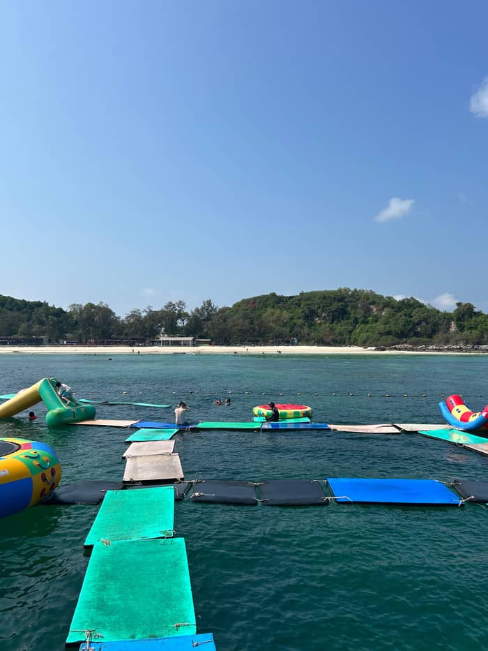
The pier of Na Ban village on the east side of the island; the city's songthaew routes to the beaches start here.
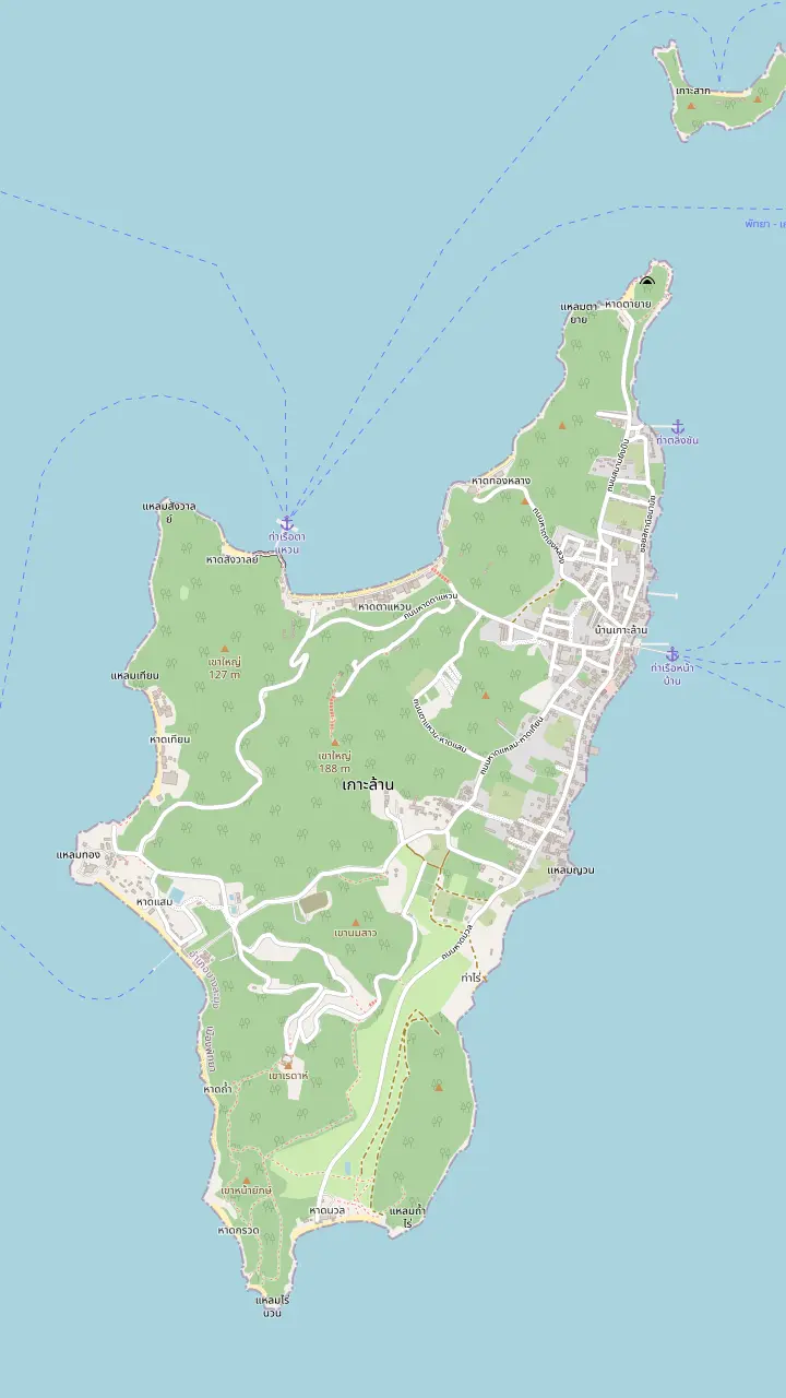
Google MapsA pier at the north end of Tawaen Beach on the map, on the same side as the Sangwarn and Tong Lang bays.
Google MapsAbout 750 meters of white sand with coral at both ends, on the north side of the island.
Google MapsA beach of 500 meters on the west side; people move here from Tawaen in the monsoon season.
Google MapsA quiet beach of 350 meters in the southwest with a walkway and restaurants.
Google MapsA small, quiet beach where the main activity is snorkeling to see corals; glass bottom boats are the alternative.
Google MapsA small beach of 150 meters beside Tawaen, quieter than its neighbour.
Google Maps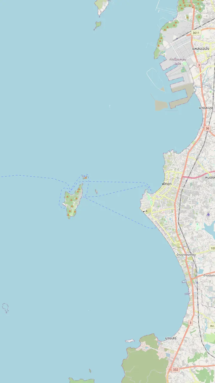
A mountainous island about 7.5 kilometers off Pattaya shore, covering 4.07 square kilometers.
Google MapsThe pier of Na Ban village on the east side of the island; the city's songthaew routes to the beaches start here.
Google MapsA pier at the north end of Tawaen Beach on the map, on the same side as the Sangwarn and Tong Lang bays.
Google MapsAbout 750 meters of white sand with coral at both ends, on the north side of the island.
Google MapsA quiet beach of 350 meters in the southwest with a walkway and restaurants.
Google MapsA small island 550 meters long with a single beach.
Google MapsThe island of Koh Sak lies 8 kilometers from the shore and has two white-sand beaches.
Google MapsThe South Pattaya pier from which the boats to the island leave.
Google MapsA hilltop lookout over Pattaya Bay that the day tour from Bangkok adds at the end of the day.
Google Maps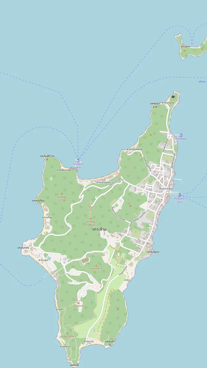
About 750 meters of white sand with coral at both ends, on the north side of the island.
Google MapsA small beach of 150 meters beside Tawaen, quieter than its neighbour.
Google MapsA small, quiet beach where the main activity is snorkeling to see corals; glass bottom boats are the alternative.
Google MapsA small beach of 100 meters, quiet and shaded, with white sand and stones.
Google MapsA beach of 500 meters on the west side; people move here from Tawaen in the monsoon season.
Google MapsA quiet beach of 350 meters in the southwest with a walkway and restaurants.
Google Maps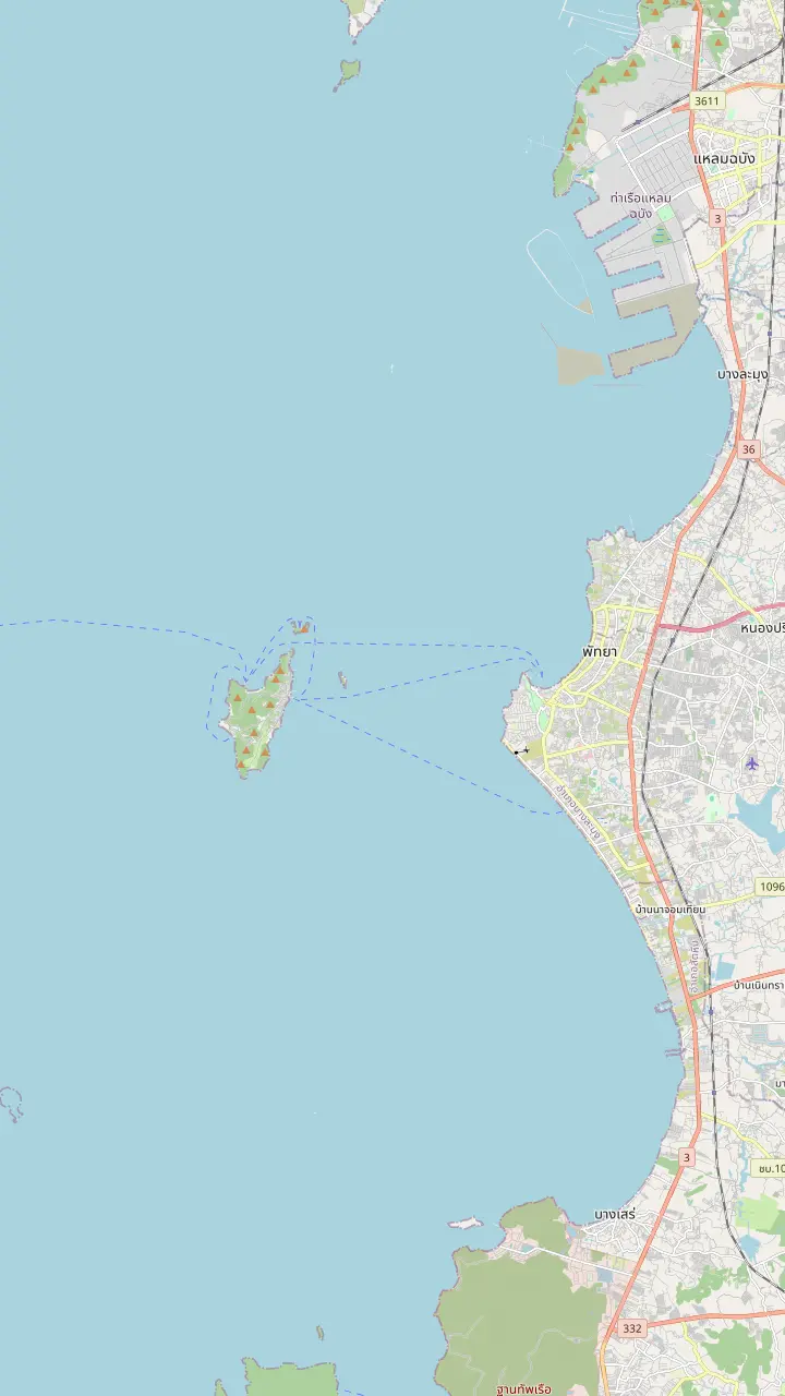
The South Pattaya pier from which the boats to the island leave.
Google MapsThe pier of Na Ban village on the east side of the island; the city's songthaew routes to the beaches start here.
Google MapsA pier at the north end of Tawaen Beach on the map, on the same side as the Sangwarn and Tong Lang bays.
Google MapsA mountainous island about 7.5 kilometers off Pattaya shore, covering 4.07 square kilometers.
Google MapsA hilltop lookout over Pattaya Bay that the day tour from Bangkok adds at the end of the day.
Google Maps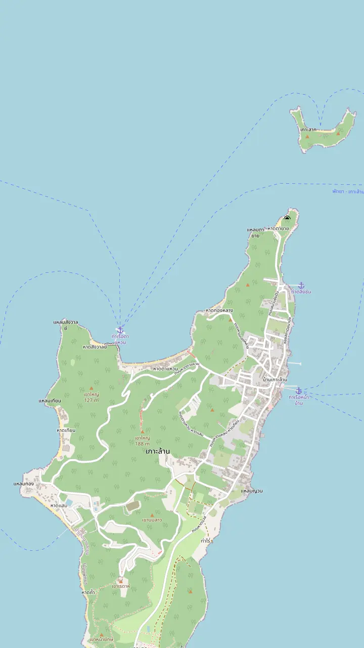
The pier of Na Ban village on the east side of the island; the city's songthaew routes to the beaches start here.
Google MapsAbout 750 meters of white sand with coral at both ends, on the north side of the island.
Google MapsA beach of 500 meters on the west side; people move here from Tawaen in the monsoon season.
Google MapsA quiet beach of 350 meters in the southwest with a walkway and restaurants.
Google MapsThe island of Koh Sak lies 8 kilometers from the shore and has two white-sand beaches.
Google MapsMap © OpenStreetMap contributors
A plain answer on ride-hailing, then the transport the city and TAT actually describe on the island: minibus routes, fares from the city's table, motorbike taxis, rental rules and how to reach the right pier for the boat home.
Editorial team, kohlarntour.click · Updated November 12, 2026 · A 7 min read
Summary view
People type does Koh Larn have Grab because they are used to a phone solving transport. We found no official source that lists a ride-hailing service on the island, and none that rules one out, so this page does not promise a car on demand. What the sources do describe is older and simpler: TAT's Pattaya page says that minibuses and motorbike taxis are in service on the island.3
The city's own yearly report agrees and puts numbers on it. Its table of land transport on Koa Larn lists songthaew minibuses and motorcycle taxis, with the routes, the number of vehicles and the starting fares.1 That is the official picture of getting around, and it is the one this page follows. If an app works on the day, treat it as a bonus rather than a plan.
A practical habit follows from that. Decide before you land how you will cross from the pier to your beach, carry small notes for fares, and write down the time of the last boat you need to catch. Most day trips solve the problem for you with an organised transfer, so check your own listing's stop list before you worry about hailing anything at all.
Options compared
| Option | What the sources give | Watch for |
|---|---|---|
| Songthaew | Routes from Na Ban, fares from THB 401 | Shared, fixed routes |
| Motorbike taxi | On demand, fares from THB 202 | Helmet for every rider4 |
| Rented motorbike | TAT says you can rent one3 | Licence or IDP required10 |
| Walking | The island is about 4.65 km long5 | Heat and hills8 |
| Boat cruise | Speed boats to nearby islands take 15 minutes11 | Weather can stop sailings |
Fares are from the city's table of February 2018 and TAT guidance; confirm current prices on the day.1
The songthaew is the island's shared pickup. The city's table lists routes from Na Ban to Tawaen Beach, from Na Ban to Samae and Tian Beach, and from Na Ban to Nuan Beach, plus runs from Tawaen to Samae and from Tawaen to Nuan.1 Na Ban is the village pier on the map above, so every route radiates from the place most boats arrive.
The same table gives fares that start from THB 40 a person and increase with the distance.1 It also counts 33 songthaew minibuses on the island.9 Those figures date from the table's February 2018 edition,9 so read them as an outline of the system and confirm today's fare before you board, since prices drift.
Songthaews are shared, so they fill up, leave when they are ready and go where the route goes rather than where you would like. That suits a simple plan, such as the pier to Samae for lunch, and it suits a group who are happy to adapt. For a precise itinerary with several beaches, a motorbike taxi or a rental gives you more control, at the cost of more asking.
Motorbike taxis are the other service the sources name. The city's table lists motorcycle taxis on demand, 120 of them, with fares starting from THB 20 a person and increasing with the distance.2 The count is a registered figure as of the table, not a promise of availability, but it suggests how common they are compared with the songthaews.
Ask the fare before you climb on. The table's pricing rule is the same shape as the songthaew's: a starting fare plus a rise with distance.2 A driver who quotes a flat figure for a short hop is not breaking any rule, yet you are entitled to ask how the number was reached, and a polite question is usually enough to settle it. Agree the amount before the engine starts, and have the right change ready.
Helmets matter on every motorbike ride. TAT's driving guidance says motorbike riders and passengers must wear helmets.4 That includes the passenger on a taxi, so do not accept a ride without one, and do not ride in flip-flops if you can avoid it. A driver who offers no helmet is telling you something about the rest of the ride. The island is 90% mountainous by the city report, so expect slopes between beaches.5
Pick your transport
Match your plan, your budget and your confidence to the transport that the sources describe.
If I want the simplest ride
Songthaew
The city's table lists fixed routes from Na Ban.1
If I am travelling alone and short of time
Motorbike taxi
Taxis run on demand from THB 20.2
If I want to see every bay my own way
Rented motorbike
TAT says you can rent a motorbike and ride it yourself.3
If I have no licence
Songthaew or taxi
Rental needs a valid licence or IDP.10
If I am staying near one cluster
Walk
Sangwarn is beside Tawaen.7
If I want a boat circuit
A cruise listing
A listing includes a boat cruise of 1 hour.
Choose your ride
Shared minibus
Shared minibus on set routes
See the day trip
On-demand rides
On demand
See the day trip
Licence needed
Your own wheels
See the day tripTAT's Pattaya page offers the adventurous another option: you can rent a motorbike and ride it yourself on the island.3 The rules for doing that legally are TAT's driving guidance. Legal driving needs a valid licence, and the accepted documents are a Thai licence, an IDP or a licence from an ASEAN country.25
Renting follows the same documents. Renting a motorbike means showing a valid licence or IDP, says TAT, which also advises choosing a reputable shop and inspecting the machine.10 It cautions that an accident without the right paperwork can leave the insurance void.12 That is a detail many renters never read, so study the terms and not only the day rate.
Keep to the left, wear the helmet and ride gently on a mountainous island with a narrow coastal road.13,5 If an accident happens, TAT says to report the incident to the police by dialling 191, and the medical emergency number is 1669.22,23 If you have not ridden a scooter before, an island is a poor place to learn, and a songthaew is the safer way to see the same beaches.
Skip the transport puzzle
Add your party size and compare trips that handle the boat and the pickup.
Compare 3 alternatives
Add your party size and compare trips that handle the boat and the pickup.
≈
View≈
View≈
ViewStarting prices as on the booking platform, converted at the ECB reference rate. You see the exact price at booking.
A day plan
Landing
Note the pier name and the boat time before leaving it.6
Transfer
The routes to Tawaen, Samae, Tian and Nuan begin at the village pier.1
Beach time
Sangwarn is beside Tawaen, so walk between neighbours.7
Midday
The sun is very strong, so sit out the hottest hours.8
Return
Leave time for a songthaew or a motorbike taxi before the boat.
The island is small enough to walk in sections. The report puts it at about 4.65 kilometers long and 2.15 kilometers wide.5 Sangwarn lies beside Tawaen on the north coast, and the city's songthaew table links Tawaen with Samae and Nuan, so a walk between neighbouring bays is realistic while a walk across the island is a different matter.7,1
Heat is the real limit. TAT calls the Pattaya sun very strong and wants lotion applied liberally and often.8 Walk in the morning, carry water, wear a hat and plan to ride back if the afternoon is hot. Shade is patchy on the coastal road, so a long walk at noon is a poor idea for anyone. A short hop that looks easy on a map can feel long when you carry a bag and the road climbs.
Use the map above to judge distance rather than a rule of thumb. The pins for Tawaen, Sangwarn and Tong Lang sit on the north coast close together, while Samae, Tien and the piers are spread around the rest of the island. Match the walk to the cluster, and ride between clusters. That is how most visitors who see several bays in a day arrange it.
Video
ActionKid on YouTube · Tap play to load the video; not before.
But if you are feeling adventurous, you can rent a motorbike to ride for yourself
Before you move
Boat trips are a form of transport too. According to the city's report, speed boats reach the other islands around Koa Larn in just 15 minutes from South Pattaya Beach,11 and a listing in our set builds a boat cruise of 1 hour from Ko Lan back to Pattaya into its day. If you want a Koh Larn boat tour around the coast rather than a beach day, check the stop list for the cruise, the swim stops and the pier you will use.
The map pins the island's piers, Na Ban and Ta Waen. Which one your boat uses depends on the operator and the day, and the listings do not name it, so ask when you buy the ticket and write the name down. Arriving at one pier while the boat waits at the other is the surest way to miss the last crossing, and a missed crossing on a small island is an expensive evening.
Weather can also change a boat plan. A listing in our set warns that in some seasons sailings can be stopped even after you reach the pier, in which case it substitutes a program inside Pattaya city. Keep a flexible mindset, and let the crew's judgement on the day outrank the schedule on the ticket. A boat that stays in port is the safer boat, and the operator's alternative plan is part of the deal.
A Koh Larn visit of a few hours can run on a simple plan. Our Bangkok day trip leaves 3.5 hours on Ko Lan, lunch and a swim included, which is enough for a bay or a pair of bays if you do not dawdle. The decision to make is between the sand near the pier and a songthaew to a farther beach, since the ride and the walk both consume the same clock.
A longer visit changes the choice. With a few hours more you can use a songthaew out and a motorbike taxi back, or the reverse, and spend the saved time in the water. If you plan to rent a scooter, start early, since the day gets hot and the rental terms, helmet and licence all take a little time to sort out before you leave the shop.
Whatever you pick, keep the return in mind. Note the pier and the boat time, check the last songthaew runs if you depend on one and carry enough cash for the ride back. A day that ends at the right pier with time to spare is a better day than one with an extra beach, and the island will still be there tomorrow. Build a buffer of an hour into the plan if you can.
FAQ
The same table lists 120 motorcycle taxis on demand, with fares that increase with distance.2
The island is about 4.65 kilometers long and 90% mountainous, so walk between neighbouring bays and ride between clusters.5
The map pins Na Ban and Ta Waen piers, and the listings do not name which one your boat uses, so ask when you book.6
Sources
Heading to Koh Larn? Ask a real person here.