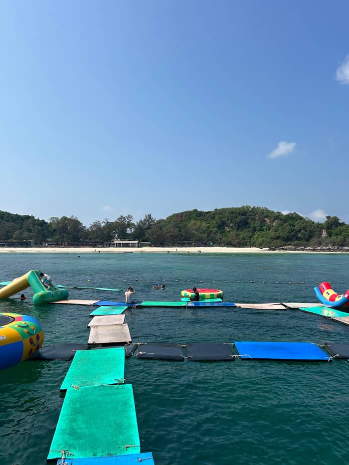
Tong Lang
For snorkelers
Corals and glass bottoms
- Main activitySnorkeling to see corals12
- Dry optionGlass bottom boats12
- Calm seasonDecember to April at Sangwarn18
Find a stop on the map
Browse 32 stops
Select a route, then tap a marker or stop to see its note and open Google Maps.
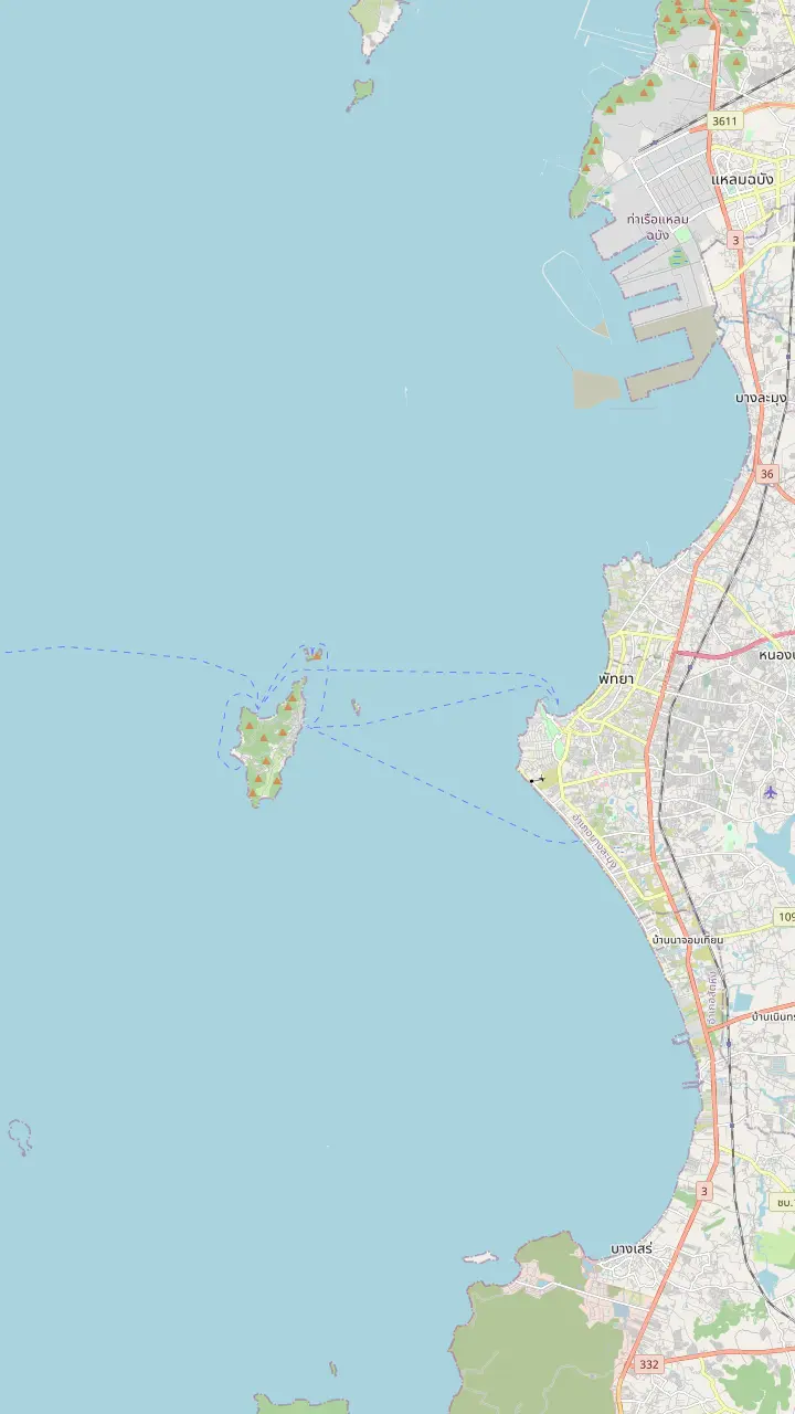
A mountainous island about 7.5 kilometers off Pattaya shore, covering 4.07 square kilometers.
Google MapsThe pier of Na Ban village on the east side of the island; the city's songthaew routes to the beaches start here.
Google MapsA pier at the north end of Tawaen Beach on the map, on the same side as the Sangwarn and Tong Lang bays.
Google MapsAbout 750 meters of white sand with coral at both ends, on the north side of the island.
Google MapsA quiet beach of 350 meters in the southwest with a walkway and restaurants.
Google MapsA small island 550 meters long with a single beach.
Google MapsThe island of Koh Sak lies 8 kilometers from the shore and has two white-sand beaches.
Google MapsThe South Pattaya pier from which the boats to the island leave.
Google MapsA hilltop lookout over Pattaya Bay that the day tour from Bangkok adds at the end of the day.
Google Maps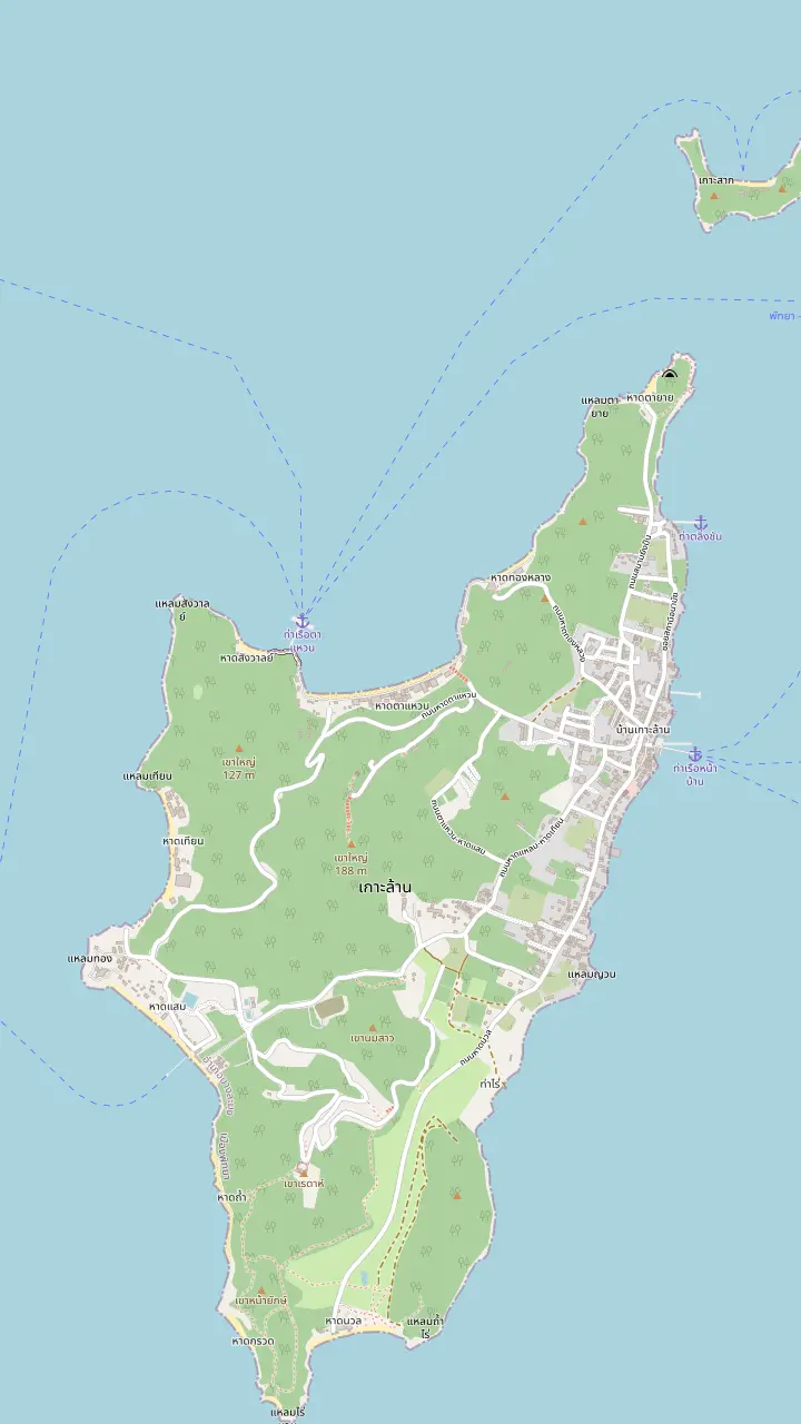
About 750 meters of white sand with coral at both ends, on the north side of the island.
Google MapsA small beach of 150 meters beside Tawaen, quieter than its neighbour.
Google MapsA small, quiet beach where the main activity is snorkeling to see corals; glass bottom boats are the alternative.
Google MapsA small beach of 100 meters, quiet and shaded, with white sand and stones.
Google MapsA beach of 500 meters on the west side; people move here from Tawaen in the monsoon season.
Google MapsA quiet beach of 350 meters in the southwest with a walkway and restaurants.
Google Maps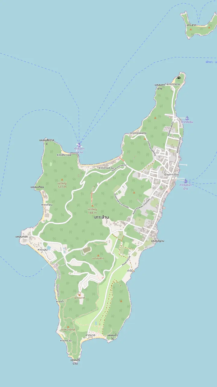
The pier of Na Ban village on the east side of the island; the city's songthaew routes to the beaches start here.
Google MapsA pier at the north end of Tawaen Beach on the map, on the same side as the Sangwarn and Tong Lang bays.
Google MapsAbout 750 meters of white sand with coral at both ends, on the north side of the island.
Google MapsA beach of 500 meters on the west side; people move here from Tawaen in the monsoon season.
Google MapsA quiet beach of 350 meters in the southwest with a walkway and restaurants.
Google MapsA small, quiet beach where the main activity is snorkeling to see corals; glass bottom boats are the alternative.
Google MapsA small beach of 150 meters beside Tawaen, quieter than its neighbour.
Google Maps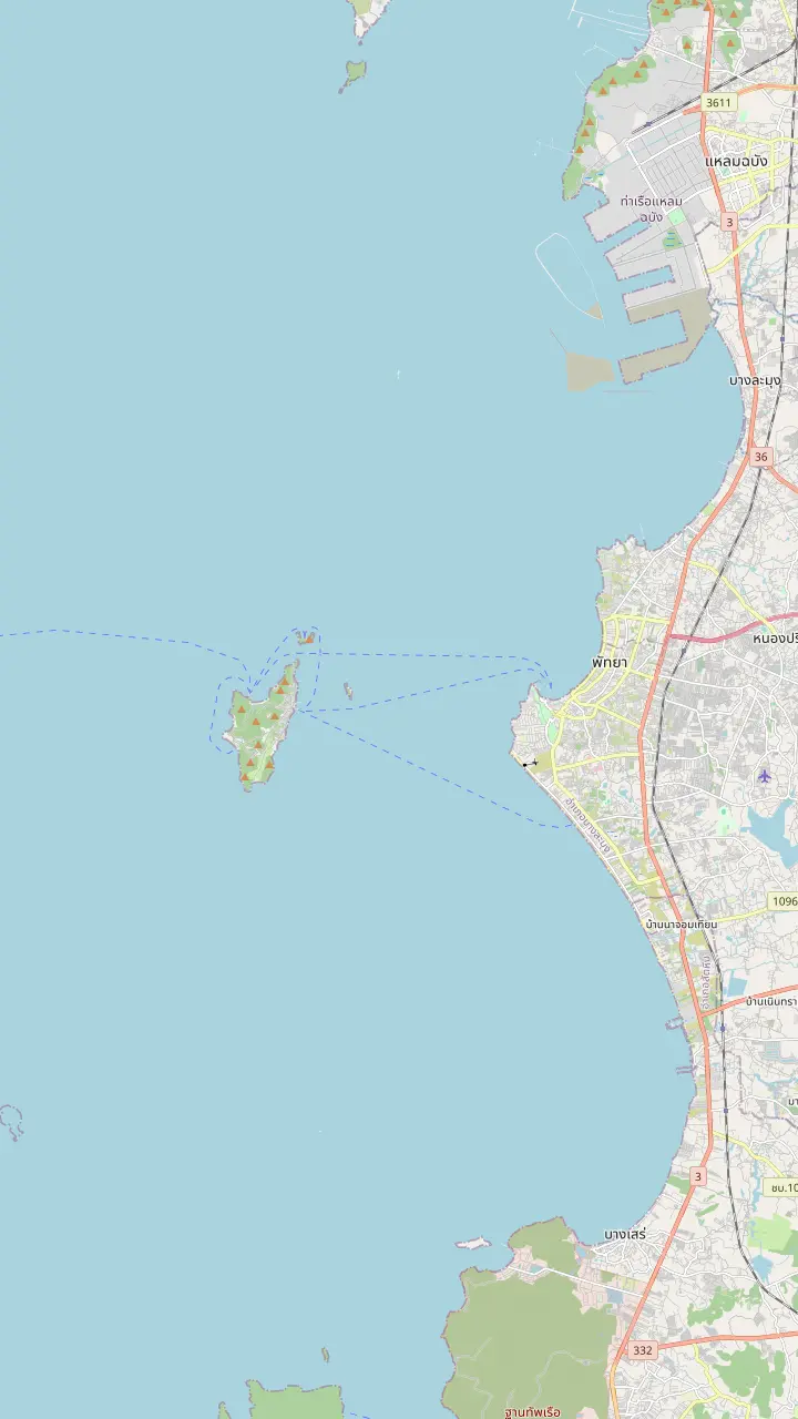
The South Pattaya pier from which the boats to the island leave.
Google MapsThe pier of Na Ban village on the east side of the island; the city's songthaew routes to the beaches start here.
Google MapsA pier at the north end of Tawaen Beach on the map, on the same side as the Sangwarn and Tong Lang bays.
Google MapsA mountainous island about 7.5 kilometers off Pattaya shore, covering 4.07 square kilometers.
Google MapsA hilltop lookout over Pattaya Bay that the day tour from Bangkok adds at the end of the day.
Google Maps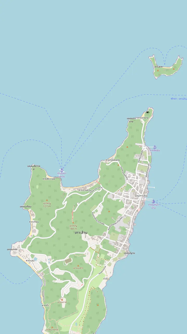
The pier of Na Ban village on the east side of the island; the city's songthaew routes to the beaches start here.
Google MapsAbout 750 meters of white sand with coral at both ends, on the north side of the island.
Google MapsA beach of 500 meters on the west side; people move here from Tawaen in the monsoon season.
Google MapsA quiet beach of 350 meters in the southwest with a walkway and restaurants.
Google MapsThe island of Koh Sak lies 8 kilometers from the shore and has two white-sand beaches.
Google MapsMap © OpenStreetMap contributors
A map-led guide to the small island off Pattaya: where it sits, what the coral name refers to, which islets lie beside it and how the city looks after the place visitors cross the water to see.
Editorial team, kohlarntour.click · Updated November 12, 2026 · A 8 min read
Summary view
Koh Larn is the island you can pick out from the beach in Pattaya on a clear day. The city's own yearly report says it can be seen clearly from Pattaya Beach, that it lies 7.5 kilometers from the shore and that it covers 4.07 square kilometers.1 The same report describes a Koa Larn group of islands, Koh Krok and Koh Sak among them, lying west of the city, with the main island placed in Moo 7 of the Naklua sub-district.6 When people search for Coral Island Pattaya, this is the group they are looking for.
The island is longer than it is wide. The report gives about 4.65 kilometers at its longest and 2.15 kilometers at its widest, and it says 90% of the area is mountainous.4 Set that beside the pins on the map above and the layout reads easily: the beaches sit as small pockets along the coast, and the city's minibus routes link them from the village pier rather than across the hills.7 Plan the day around the coast, not around a straight line from one side to the other.
Smaller islands lie close by. Koh Krok is a small island 8 kilometers from Pattaya Beach, measuring 550 meters by 150 meters, with a single beach.8 Koh Sak lies 8 kilometers from the shore and has white sand, accommodation and restaurants.9 A boat day in our set visits Koh Sak ahead of the main island, which shows how the neighbours get stitched into a single boat day.
The group at a glance
| Place | What the city report gives | Detail |
|---|---|---|
| Koh Larn | 7.5 km from the shore, 4.07 square kilometers1 | The main island, mostly hills |
| Koh Krok | 8 km from Pattaya Beach, 550 m by 150 m8 | A single beach |
| Koh Sak | 8 km from the shore9 | Beaches, lodging and restaurants |
| Bali Hai Pier | South Pattaya Port19 | Where boats to Koh Larn leave |
| Crossing | 15 minutes or 45 minutes2 | Speed boat or normal boat |
All figures come from Pattaya City's yearly report; the island group is described there under the Koa Larn spelling.6
The English name is not a marketing invention. Pattaya City's report records that tourists once called Koh Larn the coral islands, since many kinds of sea coral grow around it.3 This page uses the coral name for that reason. Boat tickets and signs may use the island's own name instead, so keep both in mind when you search or book. Both names mean the same place, and either will find you the right pier.
Pattaya City's report goes further on the coral reefs near Pattaya: reefs in Chonburi are found in just 2 places, the Koa Larn group and Koa Samaesarn near Sattahip.17 We could not find a current official reef survey for the island that we could cite, so this guide says where the city report points to coral and does not grade how healthy it is. A glossy photo of a reef is not a measurement, and neither is a tour listing.
The same report is specific about where the corals are on the beaches. Tawaen has coral lines at both ends,10 Tong Luang is a small, quiet beach whose main activity is snorkeling to see the corals, with glass bottom boats for visitors who prefer not to walk or snorkel,12 and the report adds that few tourists reach Nuan Beach, where corals can be seen.16 Sangwarn adds a seasonal note, as the report ranks December to April highest there for coral viewing in a calm sea.18
Koh Larn tourist attractions are not all beaches. Near Samae Beach the city report points visitors to a building that saves power with a solar system and to a nearby windmill farm that produces electricity.15 It is a small reminder that Koh Larn is a place where people live and where the city runs real infrastructure, not only a backdrop for a swim. A walk past the turbines makes a change from the bay if the sea is rough.
The report's list of temples under Pattaya City includes a temple on the island, Wat Maisamrarn in the report's spelling, in Moo 7 of Naklua.22 If you visit a temple, TAT's travel tip is to dress respectfully and slip your shoes off before stepping into a Buddhist temple.23 A scarf or sarong in the day bag settles the dress question on a hot day, and it costs nothing to carry. Shoes that slip on and off make the temple stop quicker still.
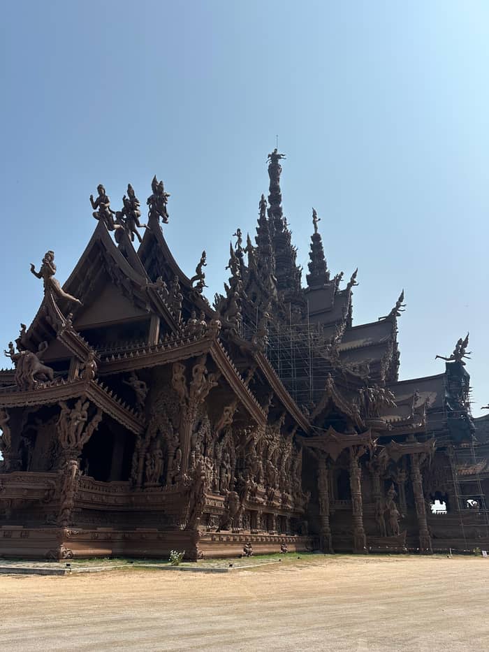
Day tours from Bangkok often finish on the mainland rather than the island. The listing we sell ends with the Pattaya View Point for 15 minutes, a hilltop lookout over the bay, after the boat back from Koh Larn. The island has lookouts of its own, but we found no official page that names or ranks them, so we leave them unnamed rather than guess at a viewpoint you may not find. Ask at the pier or at your lunch stop, and let a local point you to a favourite.
Choose your corner
Pair what you want from your visit with the beach or neighbour the city report describes.
If I want to see corals
Tong Lang Beach
The report calls snorkeling the main activity there.12
If I want a long white beach
Tawaen Beach
About 750 meters of white sand and clear blue water.10
If I want quiet and shade
Ta Yai Beach
The report describes it as quiet and shaded.20
If I want lunch and a walkway
Samae Beach
The report mentions standard restaurants there.14
If The monsoon has started
Tien Beach
The report notes a move there from Tawaen during the monsoon.13
If I want a neighbouring island
Koh Sak
The report lists accommodation and restaurants there.9
Corals, quiet or lunch
Tong Lang
Corals and glass bottoms
Ta Yai
Small, shaded bays
See the day trip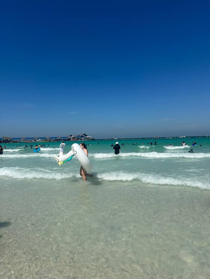
Samae
Walkway and restaurants
See the day tripKoh Larn is not a wild outpost. The report counts Koa Larn, Koa Krok and Koa Sark among the areas governed by Pattaya City, about 8 kilometers from the shore,5 and it lists a Koa Larn Branch office of the city for general administration, safety keeping and sanitary work.29 That matters to a visitor in a practical way: the beaches, the piers and the songthaew fares are municipal matters, and the city publishes them.
Everyday services are on the island too. The city's report lists a post office for Koa Larn among the 4 in the whole city,30 and a Koa Larn Basic Community Public Health Center among its community health centers.31 These details show that the island has an everyday life that runs alongside the day-trip crowd, so a quiet voice on the beach and a bag taken home are small courtesies. They cost you nothing and they are noticed.
Safety is shared between the city and the sea. The city's sea-danger staff protect swimmers and assist tour boat owners in the water of Pattaya Beach, Jomtien Beach, Wong Amat Beach and the Koa Larn area,32 and a Jetski Tourist Assistance Centre stands on Koh Larn and opens every day.28 The city also monitors seawater in 4 areas, the Koa Larn area among them, and reports the quality within its standard criteria.33
Pick a way to cross
Add your party size and weigh up the island crossings in our set.
Compare 3 alternatives
Add your party size and weigh up the island crossings in our set.
≈
View≈
View≈
ViewStarting prices as on the booking platform, converted at the ECB reference rate. You see the exact price at booking.
Around the coast
Arrival
The village pier on the east side; the city's songthaew routes to the beaches start here.7
North coast
White sand with coral lines at the ends of Tawaen, and a small, quieter beach beside it.10,11
Northeast
A small, quiet bay where snorkelers see corals, and glass bottom boats serve those who stay dry.12
West
The beach people move to when the monsoon season roughens Tawaen.13
Southwest
A quiet beach with a walkway, restaurants and the solar building nearby.14,15
South
Private land with corals, and few visitors.16
TAT's Pattaya page says Koh Lan can be visited on a day trip, with minibuses and motorbike taxis on the island.34 That matches how the listings in our set are built. The Bangkok departure in our set leaves 3.5 hours for the island itself, lunch and a swim included, a Pattaya departure leaves 4 hours for sightseeing, swimming and snorkeling, and a multi-stop adventure trip leaves only 1 hour of free time after parasailing and Koh Sak.
What that tells you is that the island time of a tour is a choice, not a given. A trip built around the Sanctuary of Truth spends its day on the road and in the temple, while a trip built around the water gives the island a short slot at the end. Read the stop list for the hours at Koh Larn itself before you compare prices, because a cheaper ticket may simply hold less island. The hours at the beach are the part you came for, and the ride and the lunch slot are the part you pay around.
Staying longer is possible. The report shows accommodation and restaurants on Koh Sak, and the main island has its own villages and services.9 Whether an overnight suits you depends on the evening you want. A day visitor sees the island in daylight at its busiest, and a guest sees the quiet that follows. Whichever you choose, check the time of the last boat back before you settle onto a beach chair.
Video
Chante & Tristan on YouTube · Tap play to load the video; not before.
Koa Larn was formerly known among tourists as the coral islands as there are a lot of various kinds of sea corals
Before you go
Sunscreen is the easy place to start. TAT reports that the national parks authority cited studies finding that chemical compounds in some sunscreens harm coral reefs, destroying coral larvae and causing coral bleaching.35 Koh Larn is run by the city, not as a national park, so that rule is not what binds you here, but the science behind it is the reason to read the ingredient list before you pack.
TAT's advice is to choose a coral friendly, mineral-based sunscreen such as zinc oxide, and to add water-resistant lotion, a hat and long-sleeved swimwear so that less of it is needed.24 It adds that Pattaya's sun is very strong and that lotion should go on liberally and often.36 The sun advice and the reef advice pull in different directions, and the clothing answer settles the argument: cover up first, then add lotion. A rash vest and a wide-brimmed hat are cheap to buy before the trip and easy to dry on the boat.
At the water's edge the rule is the one every reef asks for: look, do not touch. A glass bottom boat or a mask lets you see coral without standing on it, and fins held clear of the bottom do the rest. Keep your hands off living coral and the creatures around it, take every wrapper home and treat Koh Larn the way you would hope a stranger treated a place you lived. That is the whole code, and it works the same on every island in the gulf.
FAQ
Pattaya City's report says the island can be seen from Pattaya Beach, lies 7.5 kilometers from the shore and covers 4.07 square kilometers.1
The city report says tourists once called the island the coral islands for that reason.3
The branch handles general administration, safety keeping and sanitary work on behalf of the city.29
The report places both about 8 kilometers from the shore, and one of our listings visits Koh Sak first.5
The city monitors seawater in 4 areas including the Koa Larn area and reports its quality within standard criteria.33
That is TAT's travel tip for Buddhist temples, and a light scarf or sarong covers shoulders and knees.23
TAT suggests mineral sunscreens such as zinc oxide, plus a hat and long-sleeved swimwear to need less.24
Sources
Heading to Koh Larn? Ask a real person here.